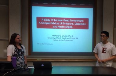
The 2006 physics and math alumna discusses her work at the Institute for the Environment at the University of North Carolina at Chapel Hill.

She developed a highly accurate simulation for predicting the level of air pollution due to road traffic, which in conjunction with a health study allowed for correleating with the level of respiratory illness in children. She then adapted the road pollution simulation as an online tool for public use.
A Study of the Near-Road Environment: A Complex Mixture of Emissions, Dispersion, and Health Effects
Michelle Snyder, University of North Carolina at Chapel Hill, Institute for the Environment, Center for Environmental Modeling for Policy Development
Abstract:
Human populations are becoming more urbanized, as people move away from countryside farms and small villages to larges towns and major cities. This migration has lead to an increase in human exposure to urban related emissions sources. The largest and most widespread impact of the urban environment is from roadways. Exposure to roadway traffic leads to many adverse respiratory health effects. To estimate these impacts a diverse network of near-road monitors have been deployed and there has been an increased effort to accurately model the dispersion of mobile source air pollutants in urban areas. These modeling and monitoring efforts will affect how future policies are designed, future transportation sources are developed, and how future cities are designed to minimize adverse health effects.
Accurately characterizing exposures in the near-road environment requires knowledge of the pollutants emitted, fluid dynamic atmospheric processes, and the effects of inhaled air pollutants on the body’s respiratory system. Knowledge of the emitted pollutants is gained from the mixture of vehicle fuel, types, and ages as well as detailed traffic patterns. These techniques are developed from statistical analysis of traffic measurements, vehicle history reports, and emissions measurements of individual vehicles. Atmospheric processes control the way the emissions are dispersed based on the surrounding geography, topography, and very localized fluid dynamics. In addition, some of the emitted pollutants chemically transform, affecting the inhaled concentrations of emitted, transformed, and background pollutants. Inhalation of shortterm spikes of exposure and long-term repeat exposure are of concern for human Health.
Characterization of the near-road environment in diverse urban settings requires applicability to many different roadway configurations and meteorological conditions. A Research LINE-source (R-LINE) Gaussian dispersion model has been developed to estimate roadway impacts in a variety of conditions. This model was developed and evaluated utilizing available field studies, near-road monitoring, and wind tunnel measurement datasets. Once the model was validated it was applied to a large urban area in conjunction with a health study of asthmatic children in Detroit, MI. The application of R-LINE requires accurate estimation of traffic volumes, patterns, and vehicle types to produce emissions, near-by meteorological measurements to model the atmospheric boundary layer, and accurate characterization of roadways features. In conjunction with air quality estimates, health data was collected from multiple study participants to develop trends in health impacts. The R-LINE air quality estimates and health trends were used to make associations between worsening asthmatic symptoms and air quality impacts due to roadway sources within the urban area.


